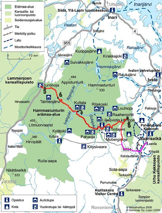
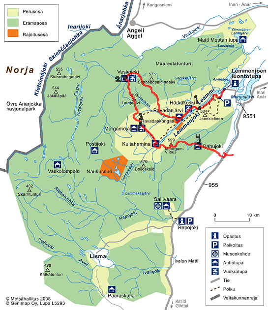
From Njurgalahti, Lemmenjoki to Laanila, Saariselkä

20.—28.7.2009

This is a story about a 8-day 160-km hike in the Lemmenjoki national park and Hammastunturi wilderness area in the Finnish Lapland. The two hikers are Timo and Tiiti Kellomäki.

Our way to hike is to go there by trains and buses, use only a map and a compass instead of a GPS, and make food out of real, dried ingredients. Timo had made a wish to 'walk more and stay the nights in huts whenever possible.'

There are some marked paths in the national park, but most of the walking was either in forests, bushes, or barren felltops. Open areas are naturally the easiest to travel, but during the dry midsummertime it's hard to find water up there. Our backpacks weighed around 25 kg in the beginning, and each day reduces the food by roughly 1 kg per eater.

Wilderness huts? The government manages some open wilderness huts in national parks and wilderness areas, and people can just walk in and stay the night. They even provide firewood and a gas cooker. Such open huts are traditional in the wilderness areas in Finland, formerly used by reindeer herdsmen or hunters. Of course we could have stayed in a tent, but the huts also offer a possibility to dry shoes and socks.

Water? Imagine carrying the drinking water for 8 days and two people. Then agree that the water has to be taken from the nature. Since there is absolutely nothing in the forests of Lapland, there's also nothing to pollute the water. Besides, the stream water is much clearer than in the southern parts of Finland. Anyway: if you find running water, you can drink it.

Food? Dried goods make tasty meals. Take soy or lentils or peas for protein, and rice or mashed potatoes powder for filling. Massive amounts of bread were also consumed. The nicest thing is: When you hike, you use very much energy. So it's OK to eat real butter.

Hmm, maybe I should write a bit more about our way of hiking, because you foreigners are so oblivious to the Finnish style... :)

See also:

The ridge is narrow but there's room for a path.

Monday, day 1 or rather just the evening

We arrived to Njurgalahti by train, bus, and finally a mail-delivery taxi. Between the bus and the taxi there was enough time to have dinner in the hotel in Inari, and to buy some food. At half past five, we were finally ready to set foot on the path to the national park.

You'd think Lapland would offer you bare fells and chill. Instead, we got something that's available in Tampere as well: ridges and warm sunshine. Such is the valley of the river Lemmenjoki. This river is wide and calm, and drops only 5 m during a 20-km flow! Additionally, there are no marshes on the banks, but nice sand. The river seems ideal to every purpose, except white-water canoeing and water power.

Having arrived so late, we did not walk very far. We found a nice camping site by the river, set up the tent, and went to sleep. Camping site? In the basic part of the national park there are so many visitors that people are adviced to use designated areas to sleep, to avoid erosion and such. There's firewood available, and a designated place to make a campfire.

Notes:

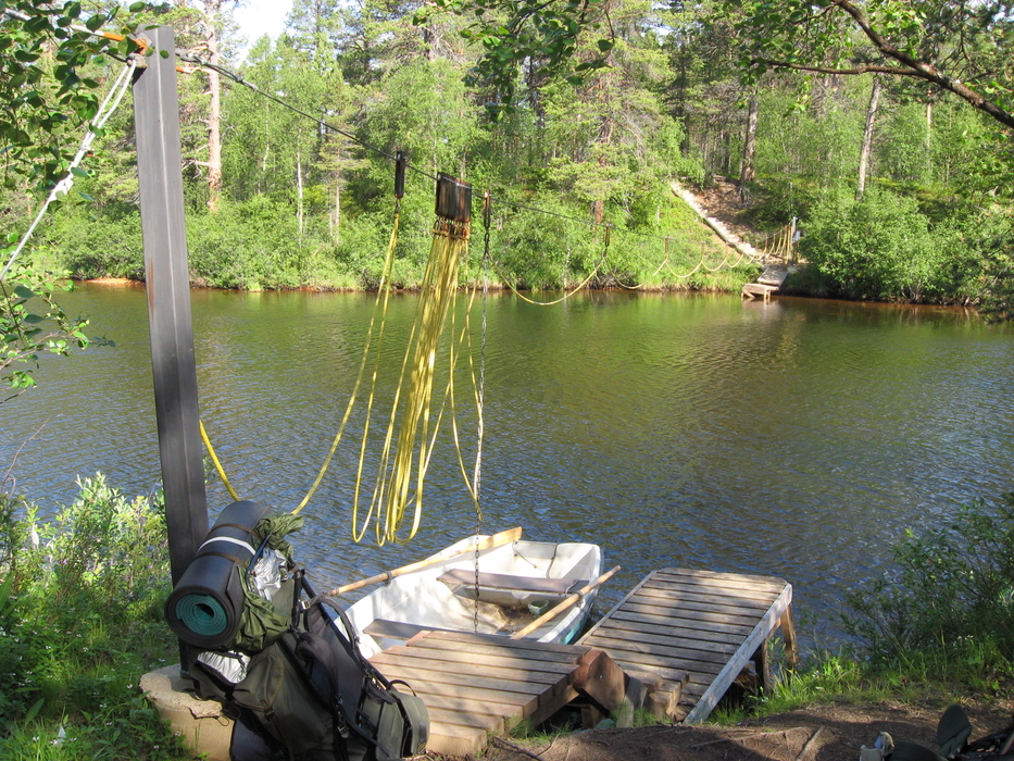
The boat transfer, built by a clever engineer.
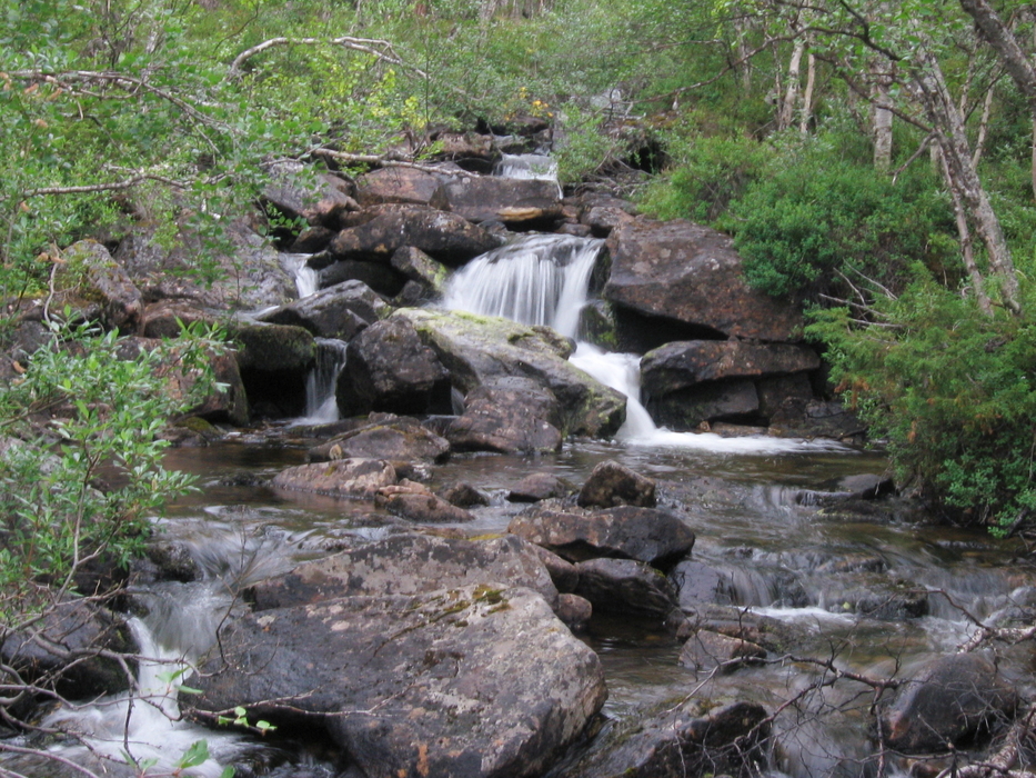
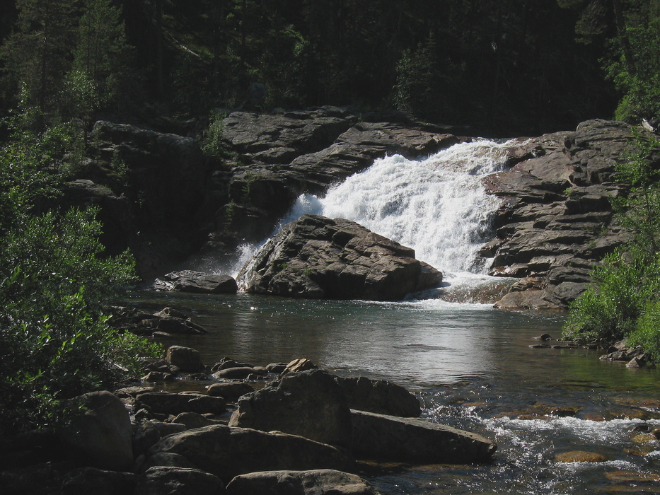
 Ravadasköngäs. 
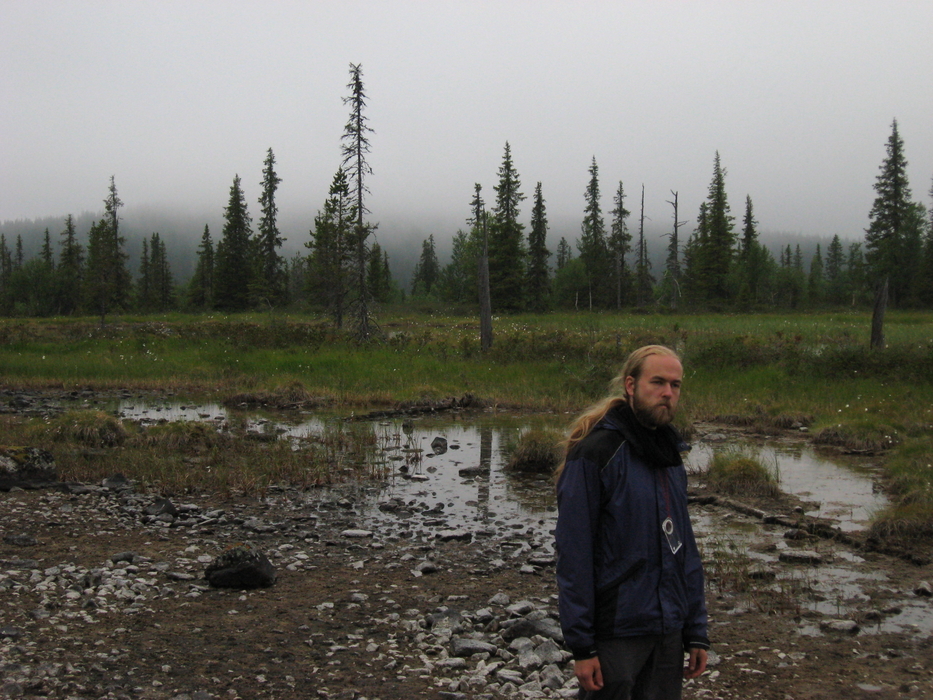
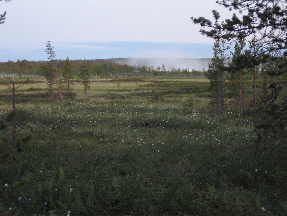
Gloomy fog from the marshland, in the middle of the night.

Tuesday, day 2

We had to cross the river. That might have been hard, but fortunately a clever engineer had thought of a boat transfer. A small rowing boat was floating next to the platform, and you could pull the ropes to get to the other side. The most clever part of this was the wire holding the ropes together. This way the rope would never be tangled up, and the frequent motor boats on the river can pass without problems.

Passing even more ridges, we arrived at the Ravadasköngäs fall. Even in the dry season it was wild and noisy. Worth checking out if you go there! We left a note in a hut diary saying that we would try to reach the Vaskojoki hut. There was no way to do that in one day, and we would probably just stay in the forest. On the way we met two guys who were planning to reach the hut by tomorrow.

It was relatively easy for Timo to orienteer along the small rivers. We were able to cross them by jumping. There were no paths anymore, after we had turned away from the marked ones, but the open area was easy to walk. We found the gorge between two fells which allowed us to pass, and then it was just downhill. Even better: shortly after arriving at the forest we found a decent path to lead us almost to the reindeer fence. Along the fence it was easy to find the hut.

The sun doesn't set in the night, and thus it was bright enough to walk in the midnight. We arrived at the hut at 1:30, the local midnight. It was almost frosty, and thick fog was rising from the marsh and the river Vaskojoki. Add the sun, and it looked like a forest fire! No idea how we managed to walk the 30 km during a day, but it seems our feet are excellent and the bodies just stopped complaining and added more endorphin.

Notes:

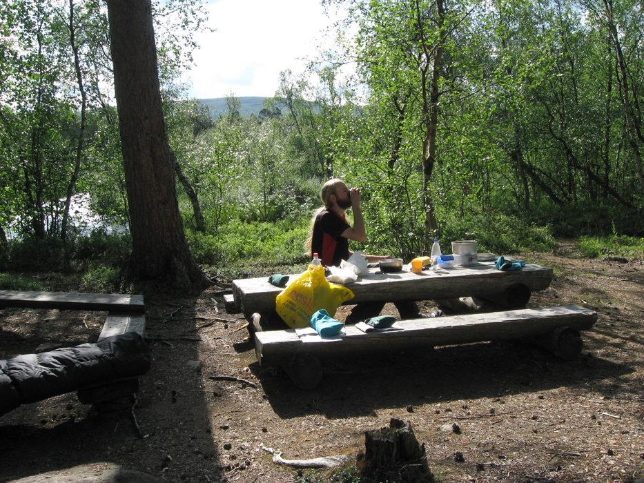
Morning glory at the Vaskojoki hut. Norway is visible at the horizon. Naturally yellow.

Wednesday, day 3

Muscles aching, we woke up after nine. Not that it matters in the wilderness. Tiiti patched Timo's pants and her own shoes. The hut's diary had an entry telling about a good path from the hut all the way up to the fell Látnjoaivi (name in the Sami language). The 1:100000-scale map shows nearly no paths. This one would have been large enough to mark!

The path sped us up, and we reached the felltop (595.2 m) quite easily. On the way, we saw the boys from yesterday, and tried to shout at them and show the path, but they did not hear us. Norway was visible in the horizon. After all the climbing and the muscles burning it was enough to turn around and see the view—it was worth all the pain!

Lemmenjoki is famous for its gold history, and the miners still wash gold there even though it is a national park. So oddly enough, there is an airfield and numerous excavators in the middle of nowhere. The airfield is nothing more than a flat bare area, distinguishable only by the floodlights. The gold mining rules in the park are very strict, and the old mining places are well hidden. We saw a running mine only once: a ditch had been narrow on the map, but in reality it had been excavated wide and we had to walk around it for a while.

This night we arrived at the hut as early as at eleven, and found four people sleeping in the well-heated hut. There was still more than enough room for us all.

Notes:

500 metres downstream this was huge. 
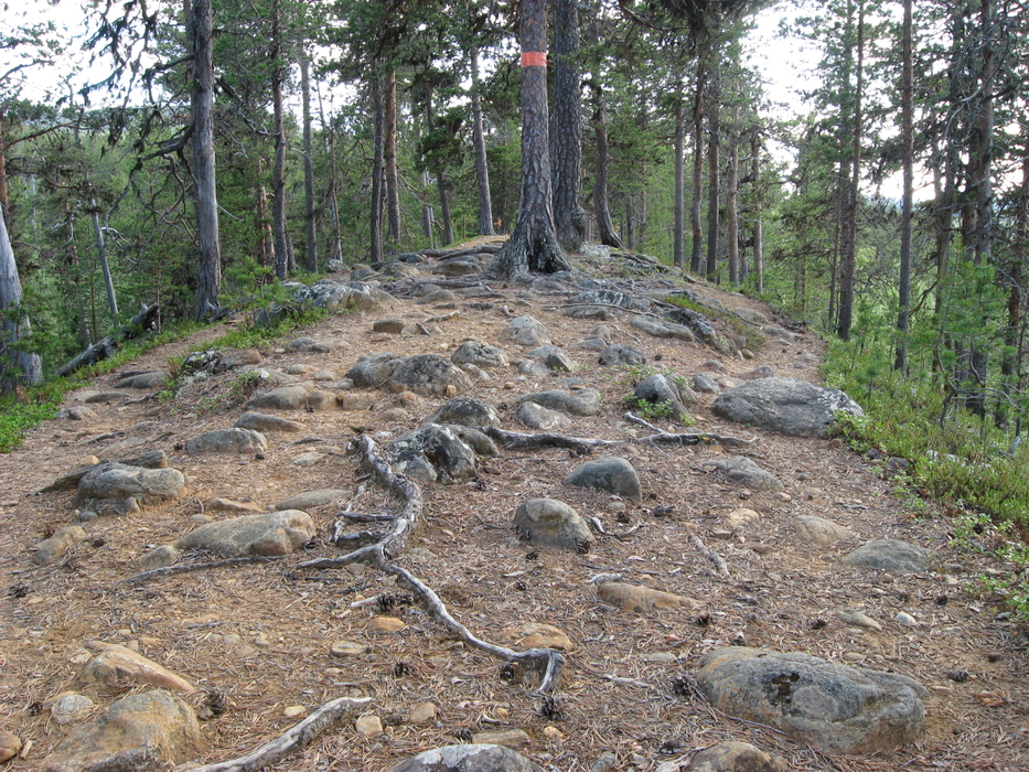
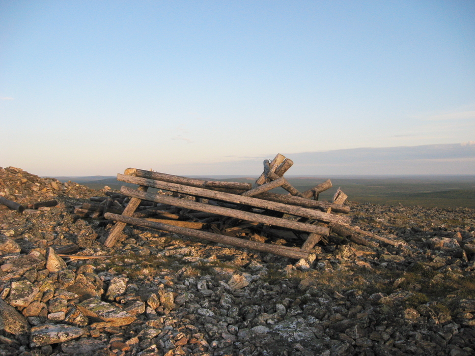
The ruins of a triangulation tower at 598.9 m. 
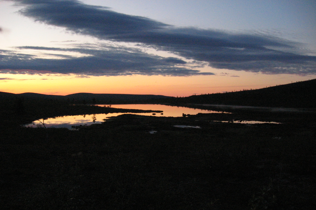
Sunset, even though the sun does not set?

Thursday, day 4

Tiiti woke up next to some old guy when someone's phone beeped at 7:30. The guy got up, said he'd been hired by a gold miner till next Tuesday, grabbed his backpack and went away. The salary was going to be 1 gram a day, and accommodation, meals, and sauna were free. "What is this for an economical crisis if one finds a job during a holiday hike?"

We had a slow morning, Tiiti identified twenty flowers in the river valley, and Timo cleaned the hut. Our shoes dried when we hung them near the ceiling in the still-hot hut. By the way, this hut (Morgamojan kultala = the goldplace of the Morgamoja stream) was originally built in the 1940s by famous gold miners. At the peak time, there was a post office, a shop, and a café. Now the hut is new, a copy of the old building, but the sauna is original. The sauna is locked but can be rented.

Back on the marked path, it was quick and easy to walk. We passed by some day-travellers with small backpacks. It's possible to take a morning boat from our starting point to Kultahamina, walk a bit, and take the evening boat back. People marvelled at our large backpacks, and some senior ladies warned us of going off the marked paths. Like we would instantly die there?

The river Lemmenjoki was very wide at Kultahamina. We had planned to ford it here. The water was too deep to ford, and besides the bottom of the river was muddy. Tiiti heroically swam across the river, holding an empty backpack (about 4 kg) in one hand. We could have taken everything else across in watertight bags. Before trying this, we met some gold miners who gladly told us that the river is fordable just a kilometre upstream. We tried, and yes, it was only ankle-deep! It's like a miracle how a lake-sized river can change so rapidly.

After the fording we climbed the fell Morgam-Viipus (598.9 m, so our heads were above 600 m). The path could be compared to the stairs of Mordor, with Timo carrying the ring and Tiiti the kettles. We had to rest at every 10-m contour. The view included two cell-phone towers, but still we didn't phone home.

The rest of the day was on bare land. The trees start only below 380 m or so, depending on the humidity and soil. Though the sun doesn't really set, we saw some fabulous sunset scenes, as well as fog. Timo took bearings from the map and so we found the Oahoaivi hut, in the middle of a forest, at two.

Notes:

Sundried socks. 
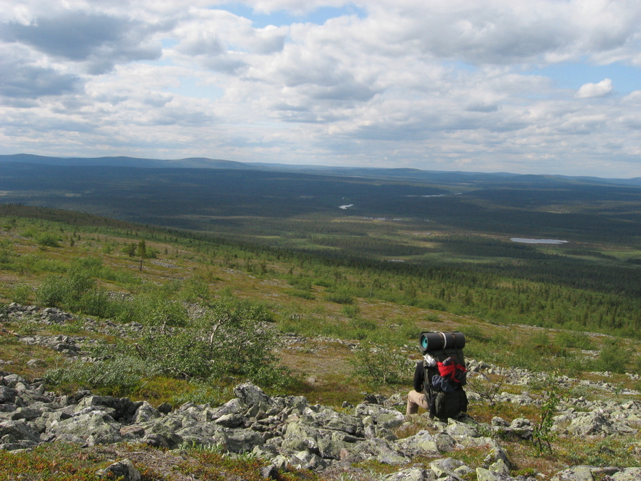
Look very closely and you will find Tiiti the red spot.

Friday, day 5

The sunny morning allowed us to dry some clothes. We also made an inventory of our food stock. It appeared that we had accidentally eaten a double amount of couscous yesterday. On the other hand, we had forgotten to eat dinner on Wednesday, so that balanced it. Naturally we had planned the meals for all the eight days, plus extra food for emergency situations.

The hut guestbook had a note from a Japanese guy whom we had met on the taxi. He had been there yesterday. So hello Yoshimasa! The national park seems to be quite small, in terms of meeting people. In terms of walking, it is very large, as was observed later today. We found absolutely no paths, and had to pass well-vegetated forests. Thus only a short mileage, though a long day walking.

Some of the wilderness huts are not open but can be rented. Such is the Juntinoja hut (Juntinoja = the ditch of a redneck). Anyway we went there to get some water from the nearby stream. Besides the water, we got smoked fish! A group of friendly Finns had rented the cabin, and they had been so lucky fishing at the river that we had to eat their excess food. Nothing could have tasted better! We paid back by telling stories about our trip, and promised to send a post card if we ever reach our destination. And so we did, back in Tampere. So long, and thanks for all the fish!

Timo claimed that four days was enough and that he'd be glad to return home. The wife on the other hand demands longer trips, and so we continued. Timo admitted that the latter half of a hike is usually as nice as the first one, and that this feeling of quitting is just a symptom that occurs halfway.

Notes:

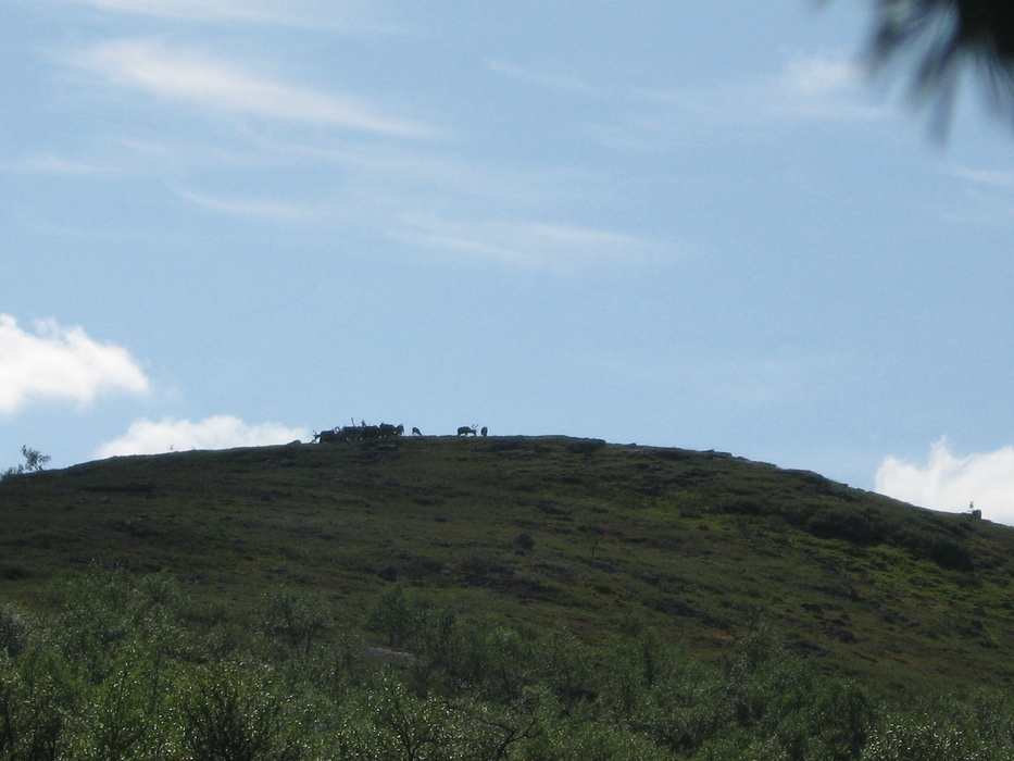
They noticed us from the distance, too. 
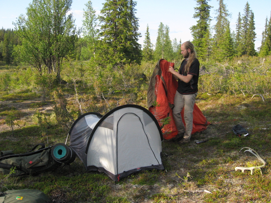
The 2-person sarcophage tent.

Saturday, day 6

Another breakfast by the Swedes: porridge cooked with the Trangia spirit cooker (se), cold rosehip soup (se), eaten with Swedish sporks (cross-breed of spoon and fork), and Timo wearing Swedish pants. Well, at least the plates and the porridge were Finnish.

Today was again a day in the forest, taking bearings and walking according to the compass. We saw some reindeer from a great distance, and latter a reindeer fence. There is always a path at the fence, and that doubled our speed. Luckily again, the marshes were dry and passable.

The most arctic tree is the birch, and pine comes the second. We reached the first firs today. The firs in Lapland look quite different from the southern ones: they are very narrow. Snow would break the branches of wide firs, and thus the so-called 'candle-shaped firs' have survived here.

We went to sleep near a small stream already at eight, after a tiring journey in the forest. Tiiti washed a bit in the stream, but it was all too cold (and small) for swimming.

Notes:

The hill Kollumi / Gollum stalking Timo through the fog. 
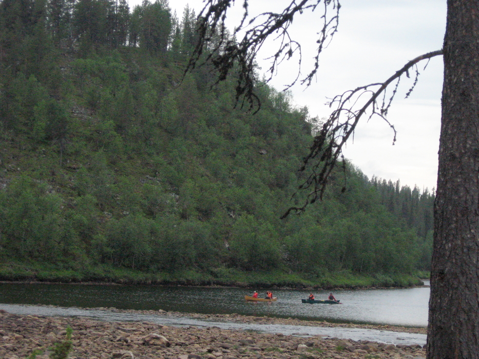
The Germans like to paddle in the downstream. Korhosenkoski. 
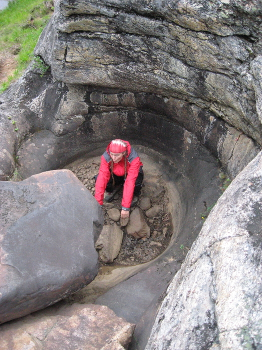
Tiiti testing the acoustic properties of a giant's kettle.

Sunday, day 7

We woke up before six, and a bit after seven we were already walking. It was a foggy morning. No chance to dry the sleeping bags in all this moisture. The sun was also not to be seen, and there was absolutely no way of telling what the time was (except for the clock, obviously). Normally one would use the sun to keep the sense of direction, but now we had to stare at the compass.

Despite the compass, we somehow lost the sense of direction and started to go round a marsh. After a while, we realised that we did not know where we were anywhere. When Tiiti was a girl guide, what did she learn about getting lost? First, stop. Keep your sugars and mood up by eating chocolate. Well, that was easy. Next, try to find your way back to a place where you knew your location. That was more challenging than it seems, with no notable landmarks.

Somehow we managed to locate ourselved on the map, and it turned out that a hill called Kollumi / Gollum had lured us in the fog. Timo checked that he still had the ring, and now that we knew where we were, we continued to the right direction. Getting lost had cost us some three kilometres and about two hours.

The route was planned so that we would appear at the river Appisjoki, cross it, then follow it downstream to Ivalojoki and spend the night at the Ivalojoen Kultala hut. Because of the hills and perhaps some orienteering errors, we found Ivalojoki first, and then followed it to the mouth of Appisjoki. At the river crossing, we had to climb 80 metres down! Luckily the path continued on the bank of Ivalojoki, and we did not have to climb back. Large parts of the river bottom were dry, and we could only imagine how wide and violent the stream must be during the springtime floods, with all the snow melting.

At the Ivalojoen Kultala hut, there were some people burning sausages on the fire. We got their leftovers, and my, how tasty it was. We ate about 300 g each. Again, we paid by telling stories and promising post cards. A lady foretold that we would have a baby girl, and that she would probably be a Capricorn, so that she would be born in the mid-winter. The lady promised to be the godmother.

In the middle of the sausage-serving and stories, Jussi from Tampere walked to our circle. He's a friend of Tiiti's since 2001 or so. Well, hello, and we did not expect to see you here! It appeared that he had started his trip at the road from Ivalo to Kittilä, at the same time as we had crossed it on Friday.

We washed and swam a bit in Ivalojoki, with the short rain starting naturally at the instant that our clothes were on the riverbank. Ivalojoki is not as warm as Lemmenjoki, but large rivers are anyway warmer than small mountain streams. Jussi had a look at Tiiti's nature book, and we exchanged sweets with the German paddler who also stayed in the hut. We went to sleep before ten.

The Ivalojoen Kultala hut is 140 years old, originally founded as a taxing station at the first gold rush time. The old main building, bakery, granary, and quarters still exist, and the last one is used as a reservable hut. It was curious to find a museum in the wilderness! There are not many objects there, but the old buildings are impressive, most of all the old logs and floor planks with the axe marks still visible. Only 12 km from the road, a nice place to do a day-trip if you are in Saariselkä!

Notes:

  • Walked 14.5 km.
  • Fog and precipitation.
  • Due to the map projection of the world, everythink is huge here near the poles.
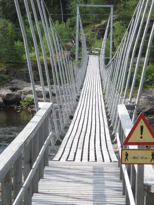
  • This bridge will last for the next 20 years. 
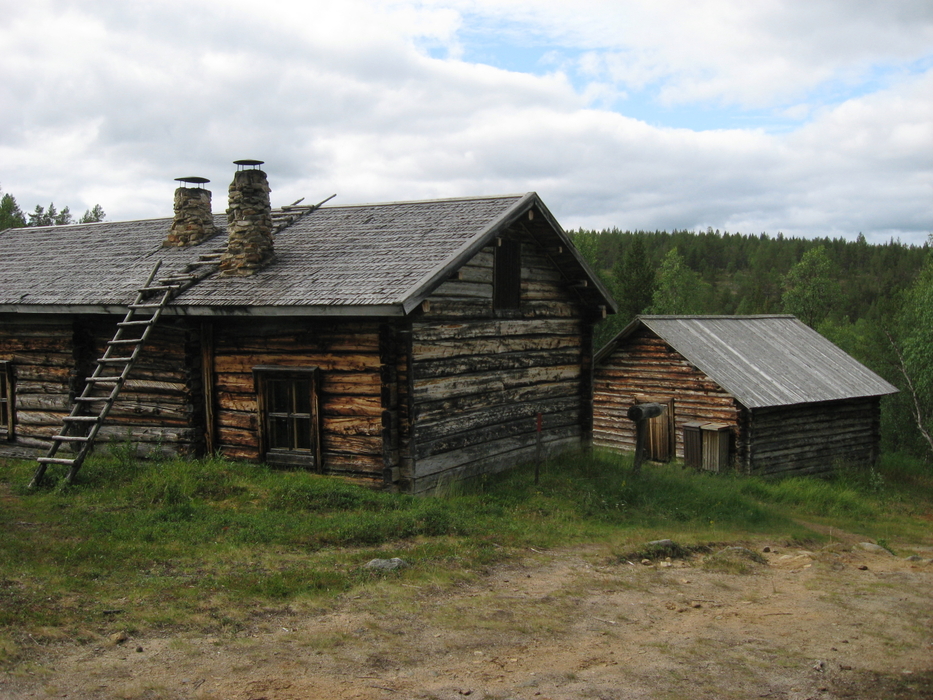
The hut is nearly 100 years old and still likes to stay in the forest. Like from the history books.

    Monday, day 8

    The bridge across Ivalojoki is made to endure spring floods. The first bridge was built in 1966, and it was washed away only 1.5 years later. The next one was built in the autumn of 1968, and it was used for 30 years. The current bridge dates from 1999. The first bridges, built by the Tunturilatu association, were completed in eight days by the work force of 40 volunteers.

    We climbed the second Mordor stairs of the trip, this time equipped with steps and handrails. After that, there was only 12 km of good path to be walked, and we reached the Pahaoja hut in no time. The sun started to shine again, and we felt like making the last day's trip in the wilderness rather than on the road.

    Gold is mined at the Ivalojoki area as well. Numerous signs point the way to claims. There are even semi-public claims that can be used by any member of the gold miners' association (fee about 20 eur/year). We followed the road to get round some swamps, and just as we were about to leave the road and cross a stream, we heard some voices. Gold miners invited us to have some tea.

    Along with the tea, we were taught how to wash gold. Tiiti's style was very careful, whereas Timo trusted that gold is nine times heavier than sand and just washed away. We both found our five nuggets. A man called Paappa (=grandpa) showed us how the 'mini formula' pan separates five nuggets from several litres of sand in ten seconds. Another miner said his record is 46 seconds with a bucketful of sand. We also heard stories of the Finnish nationals as well as the world championships. Unbelievable, but one has to believe it anyway. Now we are the proud owners of five nuggets each.

    After we left the miners and had our spaghetti-and-tuna dinner, it started to rain. The wet terrain got our shoes so wet that we felt the water running between the toes. After some hours it was also so foggy that we could barely see where we were going. So, time to set up the tent and to hope for a clear weather. Luckily the sleeping bags were dry and the woollen socks too.

    Notes:

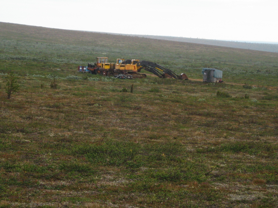
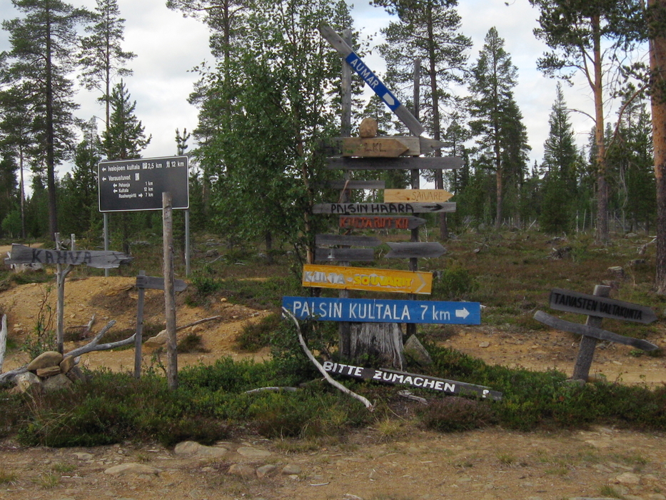
    Signs to the claims.

    Tuesday, day 9 which ends on the train

    The day did not start well: Tiiti was ill, with the stomach messed, a bit of fever, and head aching. Timo climbed down the hill to fetch some water, and cooked some blueberry porridge. Now that about 14 kg of food had been eaten, there was plenty of room in the backpacks, and we could redistribute the stuff. Timo got everything heavy (pretty much everything we had), and Tiiti the light things. We started to walk back the tractor-road we had walked yesterday, to reach the road in the hope of a hitch-hike offer.

    The shoes were wet but everything else surprisingly dry. We stopped a couple of times to squeeze the socks dry, and thus got most of the excess water out of the shoes. The tractor-road was easy to walk, and the sun began to shine.

    We heard the first car behind us after 13 kilometres of walking. The goldminer promised to get us to a restaurant near the bus stop. All the people in Lapland are so helpful and kind! The soup and soft bread served at the restaurant were delicious, and additionally we bought quite a bunch of post cards to all the helpful people. Only the bus and night train trip were to be done, and we were home at half past six the next morning.

    Walked 13 km, hitch-hiked 16 km. Many thanks to everybody who contributed to our journey!


    Story by Tiiti Kellomäki, pictures mostly by Timo Kellomäki 2009. Retkisivu / Hike page